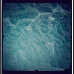
Aerial photographs of Clay and Owsley counties, Kentucky. (OCLC #921306444)
In our last Third Thursday “bring your cataloging problems” sessions, our map cataloger brought some aerial photographs of “probably somewhere in Eastern Kentucky” taken in the 1970s. They had very little metadata on them to give us clues, so she’d selected two which seemed to have the most identifying features. How were we to find their specific locations? (Or should we just catalog them more generally, with the little information we did know?)
I posted the photos to reddit on the /r/whereisthis subreddit, and within a week I had an answer, complete with a Google Earth link which matched one of my posted photos. Success! We now have a nice full record with specific subject access:
651 _0 ǂa Clay County (Ky.) ǂv Aerial photographs.
651 _0 ǂa Owsley County (Ky.) ǂv Aerial photographs.