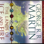
The lands of ice and fire : maps from King’s Landing to across the Narrow Sea / George R. R. Martin ; cartographer, Jonathan Roberts. (OCLC #869897510)
We received this item for cataloging: a case of 12 folded maps based on George R. R. Martin’s “A Song of Ice and Fire” books. We found two good and reasonably popular records that matched:
- OCLC #800039897 (54 holdings)
- uses the “Visual materials” workform
- main entry George R. R. Martin; Johnathan Roberts as illustrator
- physical description: 12 posters
- content type: still image
- classed in PS with Martin’s other works
- OCLC #869897510 (25 holdings)
- uses the “Maps” workform
- main entry Johnathan Roberts as cartographer; George R. R. Martin’s work included as a subject and an added entry
- physical description: 12 maps
- content type: cartographic image
- classed in G with maps
If we were adding this to our main library collection, I could see using the poster record, but we are cataloging it for the maps library, so the second is more appropriate; the individual maps will be stored flat in our map case. We checked the catalogs of other libraries who chose the map record, and found that some of them classed it under G3122 (Atlases of imaginary, literary, and mythological regions, etc), and others under G9930 (Maps of imaginary places); we’re considering this a set of maps (not an atlas) so will class under G9930.
