World maps / prepared by Nancy Amick and Ruth Bogia, the Princeton Braillists. (OCLC #82140461)
I was able to copy catalog this braille world atlas, but took the opportunity to look up all the rules I’d never gotten to apply before, including checking resources to learn more about braille.
The content / media / carrier types are:
336 __ ǂa cartographic tactile image ǂb crt ǂ2 rdacontent
337 __ ǂa unmediated ǂb n ǂ2 rdamedia
338 __ ǂa volume ǂb nc ǂ2 rdacarrier
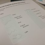
It is still unmediated (no equipment needed) and in the form of a volume, but the content is of type cartographic tactile image, as it is “intended to be perceived through touch as a still image in two dimensions”. The braille nature is also reflected in the physical description:
300 __ ǂa 1 atlas (1 volume) : ǂb braille and tactile,
    thermoform ; ǂc 28 x 29 cm
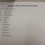
We’ll class this under the atlas call number G1046.A7: maps for the blind.
The record I found included an 007 for map information:
007 a ǂb d ǂd a ǂe z ǂf n ǂg z ǂh n
but not for tactile/braille information, so I looked that up:
- ǂa f – tactile material
- ǂb b – braille (not moon!)
- ǂd a – literary braille, alphabet, numbers, and punctuation marks commonly used in general writing (as opposed to mathematical, musical, etc. notation)
- ǂe b – contracted
Contracted braille is used for Standard English braille, and I was able to confirm several contractions in the text, such as “bl” (⠃⠇) for blind, “brl” (⠃⠗⠇) for braille, and “grt” (⠛⠗⠞) for great.
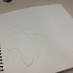
Also, I tried the recommendation for teachers, to open to a random page with eyes closed, and try to identify the region shown. It is extremely hard, even for maps of familiar regions.
Any tips from other catalogers of braille material?